![]()
We have seen from previous pages that the location reference tool is more than just a quick reference tool, but by adding maps or images to your spreadsheet data, it turns your spreadsheet into a Geographical Information System (GIS). By expanding the images to include more than just maps, we can add a visualisation element to data, such as showing heat within an engine, both in terms of it's intensity and spread.
GIS Systems typically consist of two layers of information ; Vector or Raster images depicting geography and Attribute data which highlights points on those images and information relating to it (such as towns, populations, sizes, distances, etc...). Because the Location reference tool now supports different definitions of this information, it needs options for managing this. We now have two new options for that ;
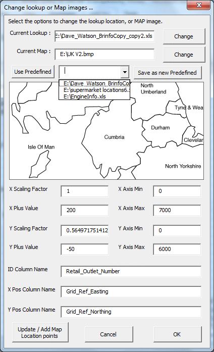
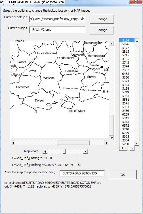
This form shows the key details relating to all of the location and attribute data we have defined. The simplest elements of this data are the locations of the image and the attribute data. Clicking change will open a file open dialogue window enabling us to locate a new source. Clicking on the drop down box (shown above) enables us to select a different source we have already defined, and we can add a new source to the ones previously defined. Below the file locations we see a preview of the map or image, and below that we have map scaling details. These scaling details are used to convert the location point X and Y co-ordinates into a point on the image. We also include the ID column name (e.g. town , location number, street, engine component), and the X and Y position column names. In the attribute data I have selected above, we have the grid reference northing and easting positions of a retail outlet, but to plot those positions on the map, I need to slightly modify the X and Y positions by multiplying by a factor, and adding a certain amount.
Sometimes we don't have the X and Y co-ordinates, for data, or we don't know scaling factors that need to be used to successfully map the data. To cater or this, we have introduced a new option to locate the specific points from our attribute data. We can use this option to locate each specific point, change the location, or calculate the necessary scaling factors. An example of this form is shown below ;
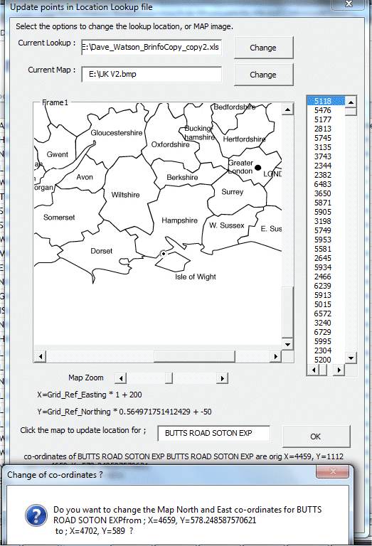
So on this map, I have clicked on the map to change the location of the selected location called "BUTTS ROAD SOTON EXP" to a new location, and the form is checking to see if I want to save this change. Clicking no, and repeatedly correcting the locations of several other points will enable the tool to calculate new map scaling and calibration factors using linear regression analysis. An example of this in progress is shown below ;